12 KiB
Spatial Search
The spatial extension allows to index datasets with spatial information so they can be filtered via a spatial query. This includes both via the web interface (see the Spatial Search Widget) or via the action API, e.g.:
POST http://localhost:5000/api/action/package_search
    { "q": "Pollution",
      "facet": "true",
      "facet.field": "country",
      "extras": {
          "ext_bbox": "-7.535093,49.208494,3.890688,57.372349" }
    }
2.0.1 Starting from this version the spatial filter it is also supported on GET requests:
Setup
To enable the spatial query you need to add the
spatial_query plugin to your ini file. This plugin requires
the spatial_metadata plugin, eg:
ckan.plugins = [other plugins] spatial_metadata spatial_queryTo define which backend to use for the spatial search use the following configuration option (see Choosing a backend for the spatial search):
ckanext.spatial.search_backend = solrGeo-Indexing your datasets
Regardless of the backend that you are using, in order to make a dataset queryable by location, an special extra must be defined, with its key named 'spatial'. The value must be a valid GeoJSON geometry, for example:
{
  "type":"Polygon",
  "coordinates":[[[2.05827, 49.8625],[2.05827, 55.7447], [-6.41736, 55.7447], [-6.41736, 49.8625], [2.05827, 49.8625]]]
}
or:
{
  "type": "Point",
  "coordinates": [-3.145,53.078]
}
Every time a dataset is created, updated or deleted, the extension will synchronize the information stored in the extra with the geometry table.
Choosing a backend for the spatial search
There are different backends supported for the spatial search, it is important to understand their differences and the necessary setup required when choosing which one to use.
The following table summarizes the different spatial search backends:
| Backend | Solr Versions | Supported geometries | Sorting and relevance | Performance with large number of datasets |
|---|---|---|---|---|
solr |
3.1 to 4.x | Bounding Box | Yes, spatial sorting combined with other query parameters | Good |
solr-spatial-field |
4.x | Bounding Box, Point and Polygon [1] | Not implemented | Good |
postgis |
1.3 to 4.x | Bounding Box | Partial, only spatial sorting supported [2] | Poor |
[1] Requires JTS
[2] Needs ckanext.spatial.use_postgis_sorting set to
True
We recommend to use the solr backend whenever possible.
Here are more details about the available options:
solr(Recommended)-
This option uses normal Solr fields to index the relevant bits of information about the geometry and uses an algorithm function to sort results by relevance, keeping any other non-spatial filtering. It only supports bounding boxes both for the geometries to be indexed and the input query shape. It requires EDisMax query parser, so it will only work on versions of Solr greater than 3.1 (We recommend using Solr 4.x).
You will need to add the following fields to your Solr schema file to enable it:
<fields>
    <!-- ... -->
    <field name="bbox_area" type="float" indexed="true" stored="true" />
    <field name="maxx" type="float" indexed="true" stored="true" />
    <field name="maxy" type="float" indexed="true" stored="true" />
    <field name="minx" type="float" indexed="true" stored="true" />
    <field name="miny" type="float" indexed="true" stored="true" />
</fields>
solr-spatial-field-
This option uses the spatial field introduced in Solr 4, which allows to index points, rectangles and more complex geometries (complex geometries will require JTS, check the documentation). Sorting has not yet been implemented, users willing to do so will need to modify the query using the
before_searchextension point.You will need to add the following field type and field to your Solr schema file to enable it (Check the Solr documentation for more information on the different parameters, note that you don't need
spatialContextFactoryif you are not using JTS):<types> <!-- ... --> <fieldType name="location_rpt" class="solr.SpatialRecursivePrefixTreeFieldType" spatialContextFactory="com.spatial4j.core.context.jts.JtsSpatialContextFactory" distErrPct="0.025" maxDistErr="0.000009" units="degrees" /> </types> <fields> <!-- ... --> <field name="spatial_geom" type="location_rpt" indexed="true" stored="true" multiValued="true" /> </fields>
postgis-
This is the original implementation of the spatial search. It does not require any change in the Solr schema and can run on Solr 1.x, but it is not as efficient as the previous ones. Basically the bounding box based query is performed in PostGIS first, and the ids of the matched datasets are added as a filter to the Solr request. This, apart from being much less efficient, can led to issues on Solr due to size of the requests (See Solr configuration issues on legacy PostGIS backend). There is support for a spatial ranking on this backend (setting
ckanext.spatial.use_postgis_sortingto True on the ini file), but it can not be combined with any other filtering.
Spatial Search Widget

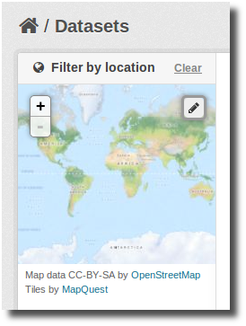
The extension provides a snippet to add a map widget to the search form, which allows filtering results by an area of interest.
To add the map widget to the to the sidebar of the search page, add
this to the dataset search page template
(myproj/ckanext/myproj/templates/package/search.html):
{% block secondary_content %}

  {% snippet "spatial/snippets/spatial_query.html" %}

{% endblock %}
By default the map widget will show the whole world. If you want to
set up a different default extent, you can pass an extra
default_extent to the snippet, either with a pair of
coordinates like this:
{% snippet "spatial/snippets/spatial_query.html", default_extent="[[15.62,
    -139.21], [64.92, -61.87]]" %}
or with a GeoJSON object describing a bounding box (note the escaped quotes):
{% snippet "spatial/snippets/spatial_query.html", default_extent="{ \"type\":
    \"Polygon\", \"coordinates\": [[[74.89, 29.39],[74.89, 38.45], [60.50,
    38.45], [60.50, 29.39], [74.89, 29.39]]]}" %}
You need to load the spatial_metadata and
spatial_query plugins to use this snippet.
Dataset Extent Map

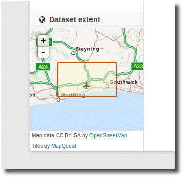
Using the snippets provided, if datasets contain a
spatial extra like the one described in the previous
section, a map will be shown on the dataset details page.
There are snippets already created to load the map on the left sidebar or in the main body of the dataset details page, but these can be easily modified to suit your project needs
To add a map to the sidebar, add this to the dataset details page
template (eg
ckanext-myproj/ckanext/myproj/templates/package/read.html):
{% block secondary_content %}
  {{ super() }}

  {% set dataset_extent = h.get_pkg_dict_extra(c.pkg_dict, 'spatial', '') %}
  {% if dataset_extent %}
    {% snippet "spatial/snippets/dataset_map_sidebar.html", extent=dataset_extent %}
  {% endif %}

{% endblock %}
For adding the map to the main body, add this:
{% block primary_content_inner %}

  {{ super() }}

  {% set dataset_extent = h.get_pkg_dict_extra(c.pkg_dict, 'spatial', '') %}
  {% if dataset_extent %}
    {% snippet "spatial/snippets/dataset_map.html", extent=dataset_extent %}
  {% endif %}

{% endblock %}
You need to load the spatial_metadata plugin to use
these snippets.
Legacy Search
Solr configuration issues on legacy PostGIS backend
Warning
If you find any of the issues described in this section it is strongly recommended that you consider switching to one of the Solr based backends which are much more efficient. These notes are just kept for informative purposes.
If using Spatial Query functionality then there is an additional SOLR/Lucene setting that should be used to set the limit on number of datasets searchable with a spatial value.
The setting is maxBooleanClauses in the solrconfig.xml
and the value is the number of datasets spatially searchable. The
default is 1024 and this could be increased to say
16384. For a SOLR single core this will probably be at
/etc/solr/conf/solrconfig.xml. For a
multiple core set-up, there will me several solrconfig.xml files a
couple of levels below /etc/solr. For
that case, all of the cores' solrconfig.xml should have this setting at the
new value.
Example:
<maxBooleanClauses>16384</maxBooleanClauses>This setting is needed because PostGIS spatial query results are fed into SOLR using a Boolean expression, and the parser for that has a limit. So if your spatial area contains more than the limit (of which the default is 1024) then you will get this error:
Dataset search error: ('SOLR returned an error running query...and in the SOLR logs you see:
too many boolean clauses ...  Caused by:
org.apache.lucene.search.BooleanQuery$TooManyClauses: maxClauseCount is set to
1024
Legacy API
The extension adds the following call to the CKAN search API, which returns datasets with an extent that intersects with the bounding box provided:
/api/2/search/dataset/geo?bbox={minx,miny,maxx,maxy}[&crs={srid}]If the bounding box coordinates are not in the same projection as the one defined in the database, a CRS must be provided, in one of the following forms:
- urn:ogc:def:crs:EPSG::4326
- EPSG:4326
- 4326